Please Register / Login to take part in discussions about the Virgin Islands.
We have a new header on the site and it shows a photo from the USVI randomly from a selection of 13.
In a recent post Gerie wrote: "I like the new look. I also love all the new pictures on the top of the page. But now, are you going to identify the locations of those pictures? Some are obvious, but others are unfamiliar."
Sooo how about a game, "Guess the Location, Island" of the images in the header. 😉
These are the 13.
1. Beach with Palm Palapas Umbrellas
2. Yellow Building
3. Beach with two Boats
4. Cruise Ships
5. Bay with darker and lighter blue water, land on left side
6. Beach with White Tower in Left corner
7. Overview of a Town with boats at Anchorage
8. Sandy Strip with water on left and right sides, rocks in front
9: Grassy shot with ocean background
10: Mostly Various Mountains with some water
11: Sandy/rocky Strip with water in front and back, little bit of land in top, left corner
12: Coconut Trees (if someone recognizes these specific trees... WOW your good!)
13: Bay/water in front with Island/mountains in background
Only some of them appear on the message board, others appear on the site itself so you will need to click through the site to see all of them.
--Islander
#10 Is it a view looking west from somewhere like the rooftop of an upper level unit at the Elysian? That would be Nazareth Bay in the foreground and Compass Point jutting out to the left, with populated areas near downtown showing in the background
I know....it's a pretty good stretch.
I like the guess Gerie, pretty good, figured that would have been a tough one. It is a view looking West, pretty sure you are right about being on a rooftop, downtown is in the background BUT its not Nazareth Bay or Compass Point. Tip: Photographer would have been a good bit directly west from Elysian...
--Islander
# 1 is Emerald Beach Hotel in Lindberg Bay
#8 Could be Mermaids Chair
You got both right exit zero!
#1. Lindberg Bay (aka Emerald Beach), St. Thomas (Beach with Palm Palapas Umbrellas) - (exit zero)
#8. Mermaids Chair, St. Thomas (Sandy Strip with water on left and right sides, rocks in front) - (exit zero)
So we've got 1 through 8. Still looking for:
9: Grassy shot with ocean background
10: Mostly Various Mountains with some water
11: Sandy/rocky Strip with water in front and back, little bit of land in top, left corner
12: Coconut Trees (if someone recognizes these specific trees... WOW your good!)
13: Bay/water in front with Island/mountains in background
--Islander
Islander, I'm exhausted from looking all over this message board and trying to guess.
I think I give up. I must have spent at least 2-3 hours looking.
We should do this more often!!
Islander and billD: Even though Lindqvist beach has been recently renamed Smith Bay Park" (AAARGH!) we locals will always call it Lindqvist and spell it correctly in honor of the Swedish family who settled here way back when. Given our transient society I.hope you understand how important it is to both recognize and preserve the history of these islands when it comes down to such basics which may seem silly to some but are important to many. Thanks!
STT Resident - thanks for the history of the beach
No matter how someone spells it - it will always be my favorite beach on STT
Of course that is based on Memories and Beauty
Beauty speaks for itself
Memories will not be shared 😉
It is not too easy to find these other photos but #13 is Caneel Bay, Scott Beach STJ--- I will keep looking for the rest
#10 if I read the description correctly -- is looking west on STT with the entrance to Benner Bay lagoon in the center
Connie - don't give up now... Tip: you were very close on one of your guesses, it just was not the right picture ;).
exit zero - #13 is not Caneel Bay/Scott Beach and #10 is not Benner Bay lagoon area. Tip: As mentioned to Gerie for the #10 picture the photographer would be quite a bit directly West of the Nazareth/Benner Bay area.
And a few more tips...
Images represent the four main islands of the USVI.
All images for St. Thomas and St. Croix have been identified. The remaining 5 are from St. John and Water Island.
AND...
When in island sections of the site only images from that island appear in the header; so click over to the St. John and Water Island sections.
--Islander
OK, I'm going to try again.
One picture, and I don't know the number is Honeymoon Beach on Water Island??
Do I win????
#13 Haulover Bay?
#12
Can't remember the location but I know I woke up looking at those trees 😎
None are Honeymoon, Water Island, but three of the five not yet identified are from Water Island - so folks still looking check out the header images on the Water Island Section of the site!
Connie, go back to pages in the St. John Section.... again you were close on one of your previous guesses - you just didn't have the right image to go with the beach you named!
Chris at Work - #13 is not Haulover. LOL on the coconut trees, at least tell me what island you were on when you saw those trees? 😉
So the five still unidentified are below:
9: Grassy shot with ocean background
10: Mostly Various Mountains with some water
11: Sandy/rocky Strip with water in front and back, little bit of land in top, left corner
12: Coconut Trees (if someone recognizes these specific trees... WOW your good!)
13: Bay/water in front with Island/mountains in background
--Islander
I said I wasn't going to do this, BUT......
9 Looking South from the Southern tip which has no name for the area on your Map!
11 East Gregerie Channell, looking at Hassel Island!
9 Flamingo Point- water Island
11 Sprat Bay
13 Showing Watermelon Cay with Tortola in backgroud- taken from to Limster Bay, below Annaberg
Sherri, I think you almost have it.
My guess: #9 shot from the Fort looking toward St Croix. #11 the tidal pool at Limestone Beach. #13 Sprat Point to the left (the photo has been flipped because Sprat Point would be to the right).
After we guess the locations then I think we should figure out the year the photo was taken. For instance: the Cruise ships at the pier in Havensight show the Kon Tiki picking up / discharging passengers between the two ships, so that had to be a few years ago. If it was a video then you could see if the passengers were getting on or staggering off of the Kon Tiki.
islander.
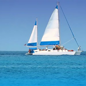
I thought the view of the sail boat on the right side was Lindquest beach. But thinking about it you can see some cays and there are no cays in your picture.
I think I know were the water on both sides are but I don't know the name. Is it on water island or Hassel island?
It would be nice when they are all identified to list them. I have to admit there are many places I don't know about on St. Croix or to a lessor degree St. John.,
Buy the way do you know what percentage of the people on the message board are from the islands?
Billd
Sherri and Rocky Dock join the fun and get some right!
For #9 Sherri was getting close with her first guess of Southern tip and with the second guess got the area and Island right, Flamingo Point, Water Island and Rocky Dock is right with adding the Fort - Fort Segarra.
For #11, Sherri you were getting really close with East Gregerie Channel and Sprat Bay, but you needed to move one bay over. Rocky Dock is right it is, Limestone Bay, Water Island.
Rocky Dock, #13 is not Sprat Point, Water Island. Sherri got it - Leinster Bay, St. John which is below Annaberg and its Waterlemon Cay and Tortola in the background. Connie, this is the one I was hinting you to look for since you guessed Leinster Bay for another image.
And Rocky Dock, you are right the Cruise Ship photo is an older one.
So just two left,
10: Mostly Various Mountains with some water
12: Coconut Trees (if someone recognizes these specific trees... WOW your good!)
Gerie and Exit Zero were getting close with their guesses for #10... just need to move the photographer west from the Nazareth Bay area of St. Thomas.... basically straight west across the water... to another island ;).
And Chris at Work... what island were those Coconut Trees on that you woke up too, you might be right!!
--Islander


