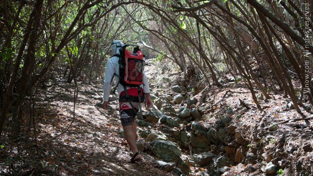
If you enjoy hiking or walking then spending time on Water Island is something you will find gratifying. Water Island is just 491.5 acres in size and its highest point is 300 feet above sea level. The roads are not steep and offer a comfortable hike, walk or run.
Below you will find directions for some hiking/walking routes on Water Island. All routes start at Phillip’s Landing, where the ferry dock is located. If you are staying on Water Island you can modify the routes depending on where you are staying. If you want to be adventurous – just walk; you are on a small island and can’t really get lost.
1. Phillip’s Landing to Honeymoon Beach
From Phillips Landing there is one road heading uphill, take this road. You will pass several homes, one with a large lawn on your right. The next house on the right is on the site of the former Providence Point Plantation. Remains of the plantation are built into the house and are visible from the road. There will be a couple of houses on the left also. You will then arrive at an intersection with roads leading right, straight and left. Continue right, down a short hill. Honeymoon Beach is at the bottom of the hill on the right side.
2. Phillip’s Landing to Limestone Beach
Follow the same directions from Phillip’s Landing to the intersection above Honeymoon Beach. At the intersection go straight. About a quarter mile down this road take the saddle road left over the small hill/hump to Limestone Road. Turn left at the next intersection. If you stop at the intersection and look right you will see the back of a stop sign. It’s a turquoise and fuchsia stop sign from the front. When you get to the first house on the right side, go down the road on the left of the house/property. The road looks like a driveway, however this is the right place. The road is a dirt road that turns into a path. Travel down the dirt path a short distance and you will arrive at Limestone beach. Limestone Beach is good for exploring. There is a reef that runs parallel to the shore. The channel behind the reef is quite deep and the waters become rough. Swimming at Limestone should be done with caution.
3. Phillip’s Landing to Fort Segarra
Follow the directions to Limestone Beach, however at the saddle to Limestone Road turn right. This road will take you past a turquoise and fuchsia stop sign. Follow the paved road to a small hill. At the bottom of the hill there is an intersection, continue left up the hill. Soon you will arrive in front of a building with a sign reading ‘Limestone Reef Terrace’. This building will be on your right as you continue up the hill. About half a mile up the hill you will arrive at another intersection. Go left, to the east, and walk up to the top of the hill and to the fort. Also in the area are gun emplacements and underground tunnels.
4. Phillip’s Landing to Carolina Point Plantation
Follow the same directions to the intersection above Honeymoon Beach, at the intersection turn left. The road continues uphill a short way. You will come upon a dirt road on your left, follow this dirt road. The dirt road leads to the Plantation ruins. An indication that you have missed the dirt road turnoff is if you find yourself walking in a residential area on a paved road.
Note Fort Segarra and Carolina Point Plantation are not set up as museums. Please explore these buildings of historical and archeological importance in a responsible, respectful and careful manner for their preservation and for your safety.
Unique and Laid-back
Water Island has a unique laid-back style and atmosphere. A favorite indicator of this uniqueness is this fuchsia and turquoise stop sign. Water Island’s laid-back atmosphere is truly the charm of the island and it is what makes a vacation or day trip there so relaxing.
It is recommended that you view the Map of Water Island to familiarize yourself with the hiking routes discussed. Do bring lots of water, comfortable shoes, a hat, sunglasses, a snack, sun block and anything else you think you might need.

